DA NANG: INTRODUCTION

The coastal city of Da Nang is known for its white sand beaches and 60km of resorts along the coast, surrounded by the majestic Truong Son mountain range. Da Nang is also a gateway to the world heritages, including the ancient capital of Vietnam - Hue Imperial City, the old trading port of Hoi An ancient town, My Son sanctuary where the temples of the Champa Kingdom gather between the 4th and 14th centuries as well as the Phong Nha - Ke Bang National Park with the carx tectonic formed from 400 million years ago.
Da Nang not only attracts visitors by its natural beauties, famous bridges crossing the Han River, but also is a center place for international and traditional events as well as night entertainment. In addition, to fully appreciate the essence and soul of the city, visitors should not miss visiting traditional markets to enjoy local cuisine and feel the friendliness through daily life of the local people.
- Location
The coordinates of the mainland Da Nang city are from 15°15' to 16°40' north latitude and from 107°17' to 108°20' east longitude. The North borders Thua Thien - Hue province, the West and South border Quang Nam province, the East borders the East Sea. Da Nang is located in the middle of the country, on the North-South traffic road, railway, by sea, by air and the end point of the East-West Economic Corridor along from Vietnam, Laos, Thailand and Burma (Myanmar).
The city has an area of 1,256.53 km², including 06 districts (Hai Chau, Thanh Khe, Lien Chieu, Ngu Hanh Son, Son Tra, Cam Le) and 02 districts of Hoa Vang, Hoang Sa islands district.
Local time: UTC + 07:00
- Population, religion:
Population: 1,134,310 people (As of 01/4/2019), ranked 39th in the country, accounting for 1.18% of the country's population, population density of 740 people/km². In which, the population living in urban areas is 988,569 people, accounting for 87.2% of the national population, the population living in rural areas is 145,741 people, accounting for 12.4% of the population.
- Weather:
Da Nang is located in a tropical monsoon climate with high temperature and little change. Within a year, there are distinctly 2 seasons: the rainy season lasts from August to December and the dry season from January to July.
From January to July: During the day, the sun is very bright, therefore a jacket and sunscreen are necessary. In the evening it is possible to wear T-shirt and short to make it easier for activities and travels.
From August to December: To avoid sudden heavy rains, raincoats and umbrellas are needed. In addition, from November to December, the weather is also cold, therfore equipping with more warm clothes to protect your body.
Table of Temperature:
|
Month |
1 |
2 |
3 |
4 |
5 |
6 |
7 |
8 |
9 |
10 |
11 |
12 |
|
Average high °C |
24.8 |
26.1 |
28.7 |
31.0 |
33.4 |
33.9 |
34.3 |
33.9 |
31.5 |
29.6 |
27.0 |
24.9 |
|
Average low °C |
18.5 |
19.8 |
21.5 |
23.3 |
24.9 |
25.5 |
25.3 |
25.5 |
24.1 |
23.2 |
21.6 |
|
- Traffic:
Located in the middle of Vietnam, on the arterial North-South traffic axis in terms of road, rail, sea and air. The city is also the end point on the East-West Economic Corridor passing through Myanmar, Thailand, Laos and Vietnam.
Da Nang Port holds its position as the No. 1 port in the Middle region and one of the most major modern seaports in Vietnam, contributing to the city's tourism development by welcoming 95 cruise ships with nearly 188.000 passengers and crew members. Currently, Da Nang port accepts about 26 container ships each week.
Da Nang International Airport is one of the three largest international airports in Vietnam (after Noi Bai and Tan Son Nhat). Flight routes of Da Nang can directly connect to Singapore, Siem Reap, Bangkok, Taipei, Guangzhou, Shanghai, Beijing, Hong Kong, Macau, Seoul, Busan, Tokyo, Osaka, Doha, Kuala Lumpur, Phnom Penh, ... As of 2019, there are 10 domestic routes from Da Nang, 36 international routes, including 24 regular direct routes and 12 charter direct routes.
The North - South arterial railway runs along the city with a total length of about 30 km. In addition to the North - South trains, Da Nang Railway Station also has local trains to meet the need of a huge number of passengers between the provinces of Da Nang - Hanoi, Da Nang - Hue, Da Nang - Quang Binh, Da Nang – Vinh, Da Nang - Quy Nhon, Da Nang - Ho Chi Minh City.
Da Nang city connects with other provinces in the country through two national highways: National Highway 1A, connecting Da Nang with provinces at the North and South; Highway 14B connecting Da Nang with the South of Middle provinces and Vietnam's Highlands. The operating of the Hai Van road tunnel shortens the traffic time and reduces traffic accidents on the Hai Van pass. By the end of 2020, Hai Van 2 tunnel will be put into operation. In addition, the introduction of two sub-regional highways, Da Nang - Quang Ngai and La Son - Tuy Loan, will help the transport system of the key economic Middle region is connected and secured.
The urban transport infrastructure is basically complete with a transport network connecting the city's ring roads, making Da Nang one of the few cities in Vietnam that rarely face traffic congestion. Many old roads have been extended and lengthened. Hoang Sa - Vo Nguyen Giap - Truong Sa road running along the south coast connects Da Nang with Hoi An. Many bridges have been built across the Han River such as Thuan Phuoc Bridge, Song Han Bridge, Dragon Bridge, Nguyen Van Troi Bridge, Tran Thi Ly Bridge ... not only create beautiful landscapes for tourists to visit the city, but also play an important role in regulating traffic
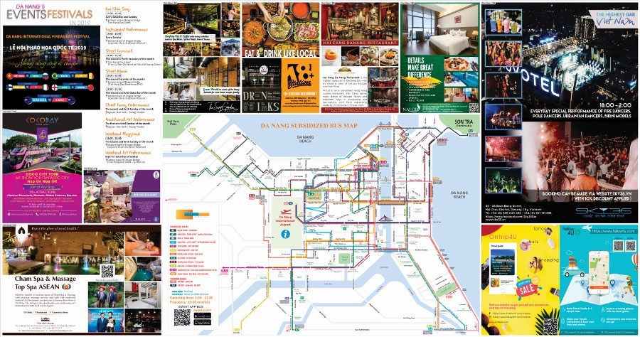
Tourist map, Bus map of Da Nang city: